
The development of Taveuni’s agriculture has increasingly been at odds with the need to protect and conserve its natural environment. As encroachment into the Taveuni Forest Reserve and Ravilevu Nature Reserve for agricultural production of dalo and yaqona expands, it has affected ecosystem services provided by these natural resources, especially watershed protection, that can lead the island into a crisis.
The reserves on the island marked by the Blue Line boundary are part of Fiji’s largest reserves. The Taveuni Forest Reserve established in 1914 has a total land area of 11,291 hectares and the Ravilevu Nature Reserve established in 1959, is 4,019 hectares in area. Also included as one of the reserves or protected areas is the Bouma National Heritage Park established in 1991. The reserves are set aside and protected for the conservation of biodiversity and natural processes of the forest. But as farmers move further inland in search for better soil fertility to expand farmlands, sections of the reserves have been illegally cleared leading to the loss of forest cover in water catchment areas. As a result, locations such as the Vuna District are now experiencing dry streams.
Director North for the Ministry of Fisheries and Forest, Mr. Maleli Nakasava said, “There are farms in the Vuna District that have crossed the Blue Line boundary and are farming within the reserves and near water catchment areas; because of these, two creeks have dried up. If this continues, what is happening in Vuna will happen to the rest of Taveuni.”
“We’re almost at the point of forcefully removing people and their farms from the reserve. It’s difficult because we’re also dealing with people’s livelihood. We’ve warned them and have given them time to move out.”
Freshwater ecosystems are also key destinations for tourists particularly Taveuni’s popular tourist
attraction such as the Lake Tagimoucia located some 800 metres in elevation in the upper reaches of the Wainikeli District. Formed from a volcanic crater, the environment around the lake and within the Ravilevu Nature Reserve and reserved forest is known for its rich biodiversity and the presence of rare plants such as the Tagimoucia flower (Medinilla waterhousei), only found in Taveuni above 600 metres altitude.
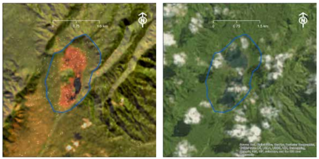
Lake Tagimoucia Satellite Imagery © Taveuni ESRAM Report 2020
According to the Ecosystems and Socio-Economic Resilience Analysis and Mapping (ESRAM) Report for Taveuni published in 2020, satellite imagery of Lake Tagimoucia in July 2016 (left) and January 1999 (right) showed a reduction in the lake levels and wetland vegetation during the 2016 drought period that followed Tropical Cyclone (TC) Winston.
It’s evident that climate change adds an additional stressor to unsustainable land use practices already at play. Achieving a balance between environmental protection and economic development is a challenge for the island.
“The main tourist attraction for Taveuni is not the beaches or the hotels, it’s the Tagimoucia flower endemic to the island. Its income for the people – we have tour operators and rental companies helping tourists get around the island. But if the Tagimoucia lake dries up, tourism will be affected as well as income for many,” said Mr. Nakasava.
“The encroachment of the reserves can lead Taveuni to a crisis in the next five to ten years.”
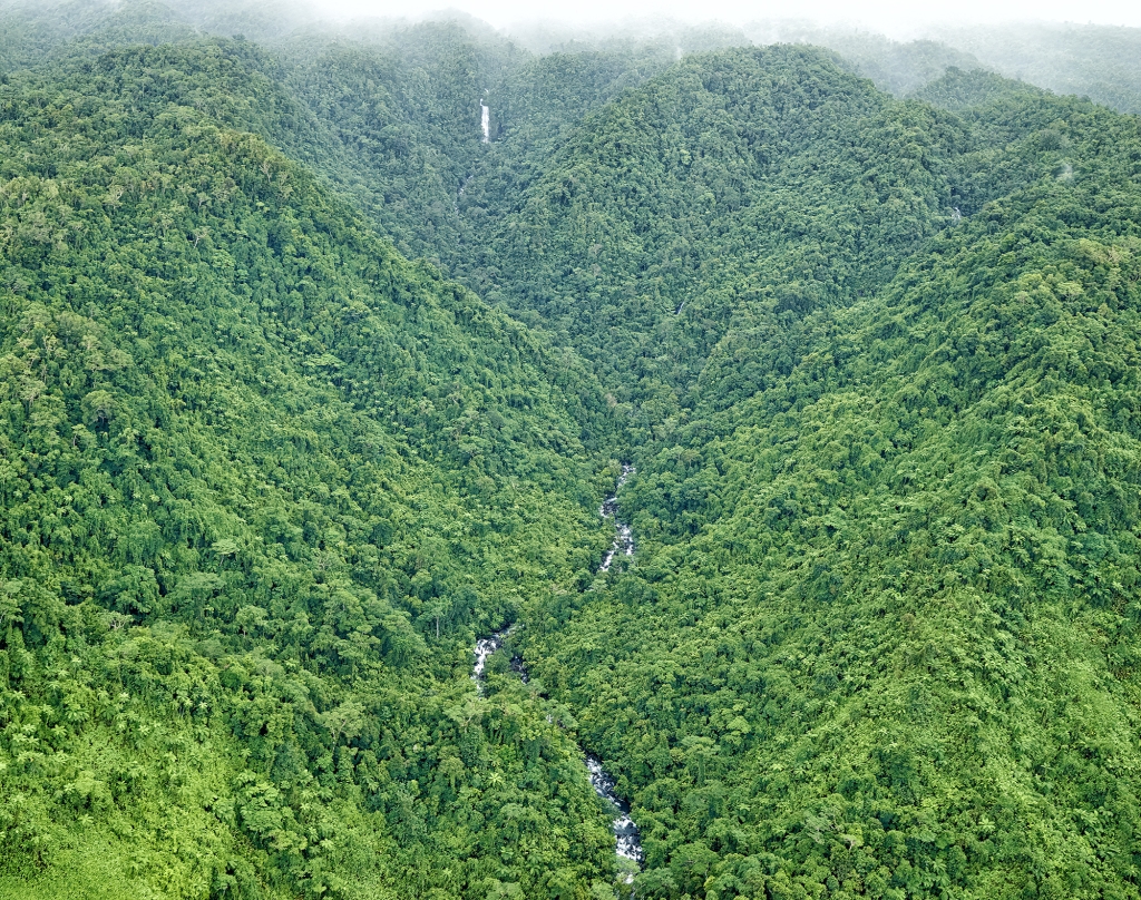
Upland forested watershed, east coast Taveuni © Stuart Chape
Chairman for the Taveuni Advisory for Delaivuna farmers, Mr. Ram Sidal said, “Most of these farmers come from outside Taveuni to farm here and they care more about their income and not so much about the protected reserves, while farmers from Taveuni know the protocol and what to do.”
While many attempt to shift the blame among stakeholders and local communities, they all agree that the reserves must be protected to build their resilience to climate change impacts and for the future.
Mr. Silas Reddy, 49-year-old farmer from Qarawalu in the Vuna District feels there needs to be a solution that’s good for the environment and good for their livelihood.
“Farmers move inland for soil fertility and end up crossing the Blue Line boundary. It would be good if farmers are introduced to crops that can still grow on their farm after a harvest and there is a market for it so there is continuous cash flow. At the end of the day, these farmers must buy uniforms for their children, they must pay bills and pay labour. The solution needs to be one that is good for the environment and good for the people and their livelihood,” said Mr. Reddy.
“A lot of the farmers are aware of the Blue Line boundary, and they only know it by name and what has been told to them, but they can’t identify where it is or locate the physical marking. After TC Winston, the markings disappeared because of the damage caused by the cyclone,” he added.
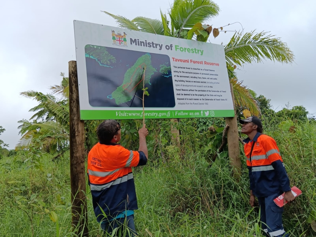
Forest Warden, Mr. Maravu Ligani and his son at the Reserves and raising awareness with farmers
The markings were redone by Forest Wardens, a position created two years ago by the Ministry of Fisheries and Forest to help maintain the blue markings, raise awareness on the protection of the Blue Line boundary and support the policing of the reserves. Forest Wardens are appointed from landowning units within the reserves and is a key priority in Fiji’s National Forest Policy to build capacity and support forest owners to sustainably manage their forests.
Mr. Maravu Ligani of Vuna and his two sons have taken on this responsibility as Forest Wardens to assist in the policing of forest laws in Taveuni and ensure the visibility of the blue markings, which is a physical blue mark on a single tree and each of these trees are about 100 meters apart.
Mr. Ligani said, “It's painful to see native trees being cleared and Tropical Cyclone Winston worsened its impact. And the use and overuse of chemical/fertilisers in farmlands in or near the Reserves is damaging the soil, the trees/plants, and animals.”
“It will take centuries for the forest to fully recover from this damage and it will need care and monitoring. It's good to see NGOs come in to help raise awareness on the reserves because many need to understand the importance of these trees - those in the village/communities, farmers, leaseholders, resort owners, tourism operators, students, everyone,"
With the positions being recently created, Forest Wardens are working through logistical challenges such as transportation to the reserves. The Ministry has plans to recruit more Forest Wardens to serve both ends of the island and provide a vehicle to support their work.
Mr. Ligani and his sons provide community awareness on the limits of forest harvesting activities, awareness on environmental standards and services as well as forest conservation. While they do not hold the power to remove people who have encroached into the reserve, they monitor forest harvesting operations and report any illegal forest-related activities to the Ministry.
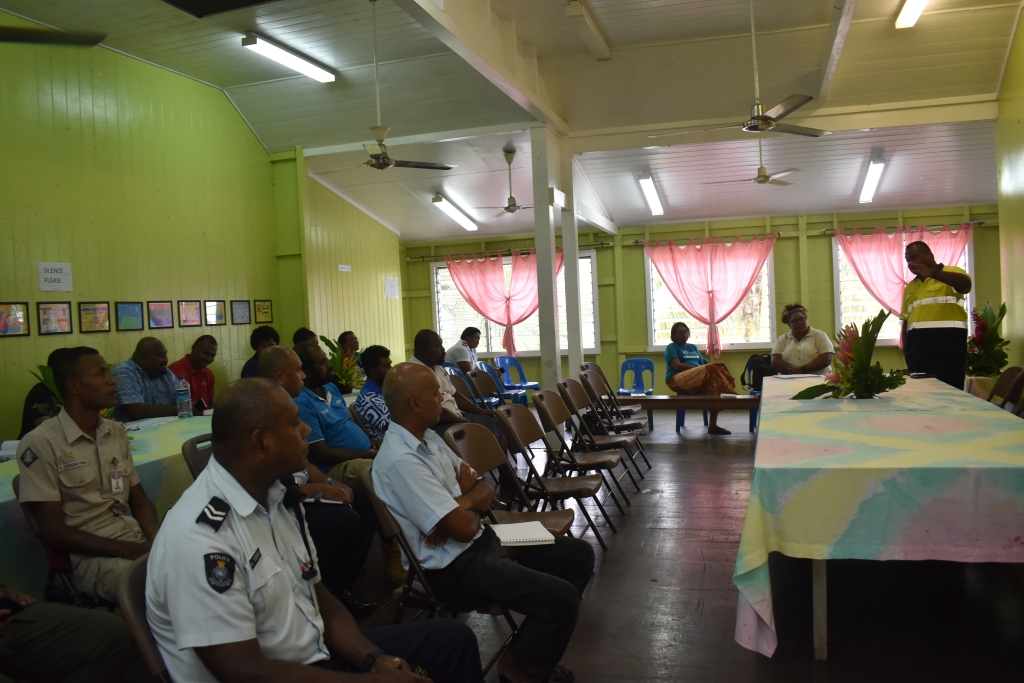
Mr. Maleli Nakasava calling for the support from government agencies;
Mr Nakasava said, “We will work with other government agencies and all relevant authorities on the island to enforce the Forest Act 1992. We are also providing technical support to the Secretariat of the Pacific Regional Environment Programme (SPREP) for implementation of the Kiwa Initiative and French GEF funded Pacific Ecosystem-based Adaptation Plus (PEBACC+) Project. We’re looking at the buffer zones located 100 to 200 meters before the Blue Line boundary where we are introducing the concept of agroforestry to help protect the two reserves.
“We’re advising communities to raise seedlings that can also provide the means to support some of the replanting activities beyond the PEBACC+ Project.”
The PEBACC+ project is working to strengthen the resilience of ecosystems, economies, and people to the impacts of climate change. In Fiji, it is focused on agroforestry and reforestation in key water catchment areas.
PEBACC+ Project Manager, Mrs. Loraini Sivo said, “Encroachment of the reserves will result in the loss of primary forest cover that can significantly affect the role of forests in the water cycle, leading to water shortages and many other problems.
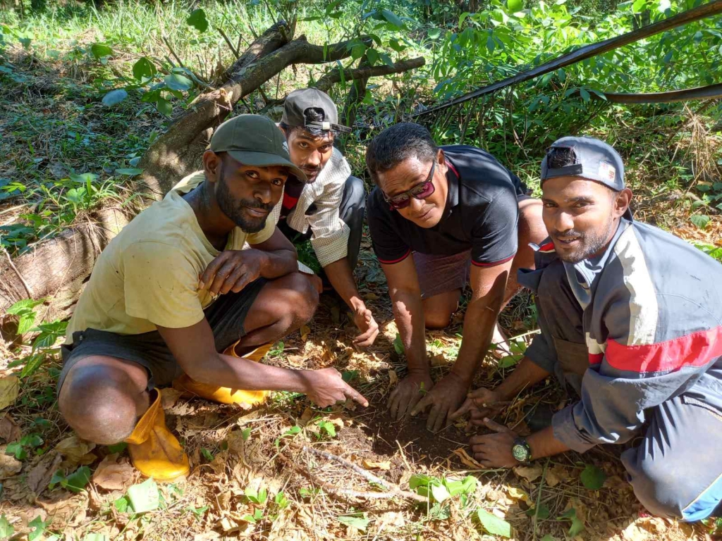
Replanting initiatives with farmers and communities
“We’re working closely with the Cakaudrove Provincial Office Conservation and the Ministry of Fisheries and Forest to replant native trees in degraded land in selected sites. We’re also engaging the Adventist Development Relief Agency (ADRA) and the Ministry of Agriculture and Waterways to train and build the capacity of farmers on the agroforestry, as well as raise awareness on the Blue Line boundary.”
The project has received ‘free, prior and informed consent’ across 13 communities to begin, has so far completed 30 hectares of community reforestation, initiated support to organic farmers and women and youth groups for a mangrove trial planting initiative.
PEBACC+ is a regional project implemented by SPREP and funded by the Kiwa Initiative – through its donors the European Union, Agence française de développement, Global Affairs Canada, Australian Government Department of Foreign Affairs and Trade and New Zealand Ministry of Foreign Affairs and Trade – with co-financing from the French Facility for Global Environment.
This four-year project is implemented in Fiji, Vanuatu, Solomon Islands, New Caledonia, and Wallis and Futuna, and will develop, sustain, and institutionalize the Ecosystem-based Approach (EbA) to climate change adaptation in these five countries and territories.